NEW 2025 – STATE PAGE LAYOUT

ALABAMA POPULATION DENSITY*
Alabama Land Area - 50,645 square miles
YEAR | PEOPLE PER SQUARE MILE |
---|---|
2020 | 99.2 |
2010 | 94.4 |
2000 | 87.8 |
1990 | 79.8 |
1980 | 76.9 |
1970 | 68.0 |
1960 | 64.5 |
1950 | 60.5 |
1940 | 55.9 |
1930 | 52.3 |
1920 | 46.4 |
1910 | 42.2 |
Hover over the charts below for more detailed information.
ALABAMA HISTORIC & PROJECTED GROWTH 1790 TO 2040*
ALABAMA POPULATION BY COUNTY*
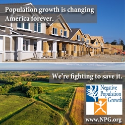
FARMS AND GREEN SPACE*
According to a USDA 2024 Study - For the years 2020 to 2023 Alabama alone lost a total of 300,000 acres of farm land. Showing a significant increase of recent land lost for farming
According to the American Farmland Trust - By 2040, depending on how Alabama handles development, it could lose a projected 310,800 to 751,500 acres of farmland.

*Sources:
Farmland Information Center www.farmlandinfo.org
Census figures from U.S. Bureau of the Census
Estimates from Weldon Cooper Center, Demographics Research Group
ALABAMA POPULATION NEWS ARTICLES